Our GPS Tracking platform supports a number of different methods of viewing live and historical data. Some proprietary owned by our customers, and some we provide.
The first mapping product using our cloud based GPS platform was a VB6/MapPoint application, originally developed by me in the 90's. It evolved to support our IP based backed. As of today, there is no web based solution that can compete, yet mapping in general has moved on in leaps and bounds. Google Street View, and satellite imagery being two obvious examples. We needed a replacement.
Silverlight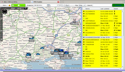
The first web based map compatible with our services for GPS tracking used Silverlight. Silverlight looked very promising, and was a natural fit for our backend servers. We use Google Protocol Buffers a lot, and we already had a .NET DLL that Silverlight could make use off. In days, literally, we had a map that could track our GPS devices in real-time. With a bit more work, we had “snail trails”, to show historical data, and an interface to our report engine. All accessible via a web URL.
However, Apples announcement that Flash would not be featured on the new iPad, was the beginning of the end of Silverlight. Microsoft started talking about HTML5 a lot, and spoke less about Silverlight. This was of great concern to me. I had already invested a lot of time in Silverlight for another project that used our backend.
HTML5 and Websockets
 HTML5 had been on my radar for a while, but up until recently was not viable for our needs. Not all browsers supported it, participially Websockets, which for us is the way to provide true real-time updates without plugins. Googles Chrome supports it today, and Firefox, Safari, Opera will do shortly, if not already in beta. IE is always going to be a problem, so nothing new there.
The only problem is, Websockets & Javascript dont really work with Binary data streams, so our backend servers need to convert to JSON on the fly. Not a major issue, but feels like a step backwards.
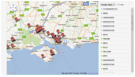
So I began work on the JSON WebSockets interface, and I commissioned a programmer to write me a prototype HTML5 map to my specifications. And here it is. It doesn’t look much yet, but it works.
 |
Stuart Johnson |